Changing Climate at Spiral Jetty
Changing Climate at Spiral Jetty
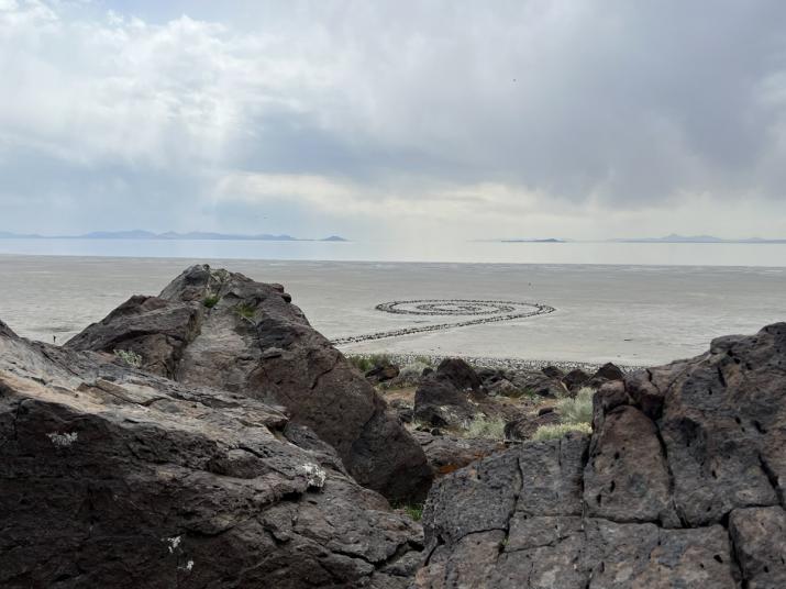
In 2022, fifty-two years after it was created, Robert Smithson’s Spiral Jetty—which is part of the collection of Dia Art Foundation—is a barometer for the climate emergency. Constructed from 6,650 tons of rock and earth, the spiral continuously changes form as nature, industry, and time take their effect. In its half-century lifetime, Spiral Jetty’s visibility and relationship to the site have changed as the waters of the lake have risen and then dropped following years of sustained drought and water diversion. The current water level of the Great Salt Lake is at its lowest since records began.
To kick-off our participation in the World Weather Network we will be looking at the changing conditions at Robert Smithson's earthwork Spiral Jetty since its completion in 1970. In our Instagram series of weather reports from the history of Spiral Jetty we will be sharing unseen film footage from its construction, as well as images of the earthwork immersed under water, of its reappearance in the 1990s covered with salt crystals, and of the situation today. See the Dispatch Log below for links to each individual post.
Thank you to Hikmet Loe for sharing her research on the changing conditions at Spiral Jetty on her website and for her guidance on this project.
Dispatch 1
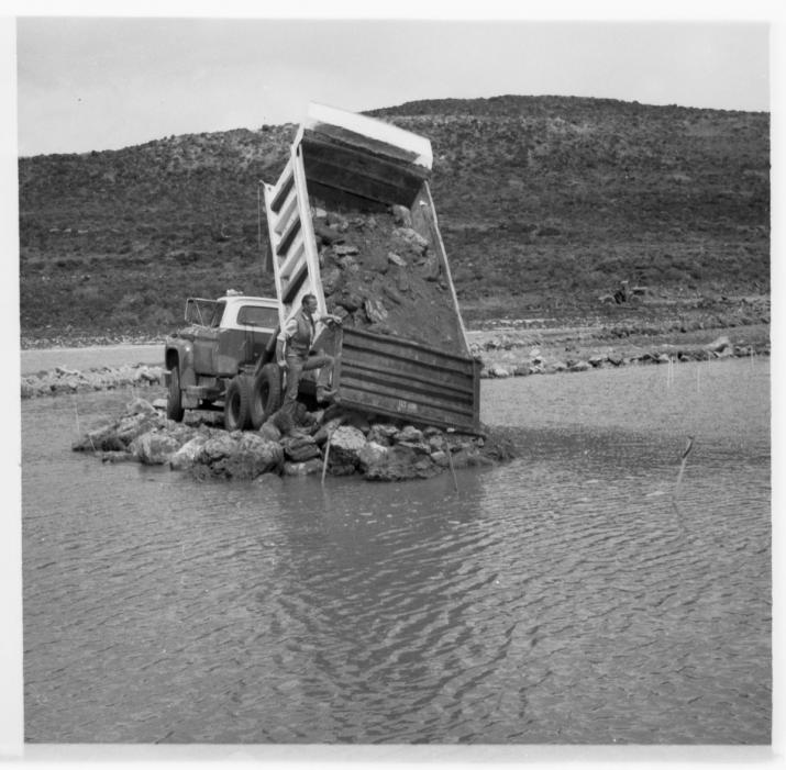
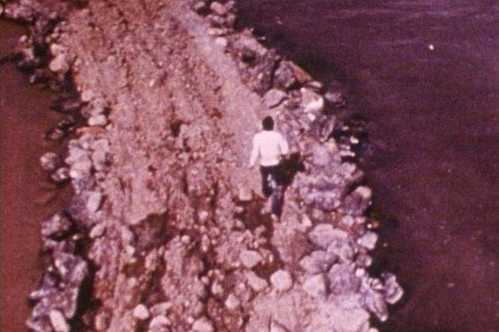
We begin with images taken by Robert Smithson during and shortly after the construction of Spiral Jetty in April of 1970. At that time the level of the North Arm of the Great Salt Lake was 4,195 feet as recorded by the United States Geological Survey.
Dispatch 2
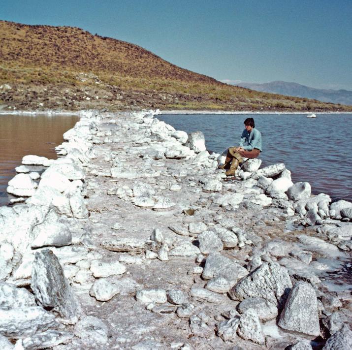
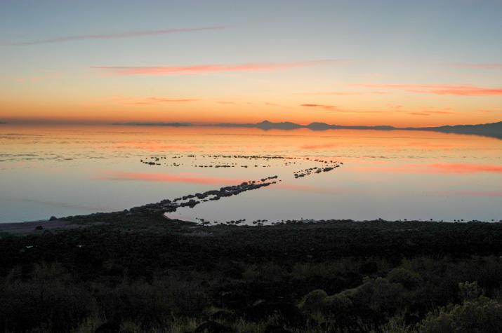
Nancy Holt took this photograph of Robert Smithson sitting on the edge of "Spiral Jetty" in August of 1971, a little over a year after the earthwork’s completion.
Dispatch 4
This image of Robert Smithson's Spiral Jetty was taken by Atsushi Fujie in November of 1990. At that time, the level of the North Arm of the Great Salt Lake was 4,203 feet—8 feet higher than the lake levels when "Spiral Jetty" was built in 1970.
Dispatch 5
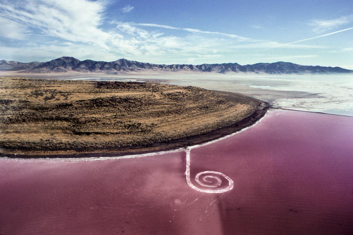
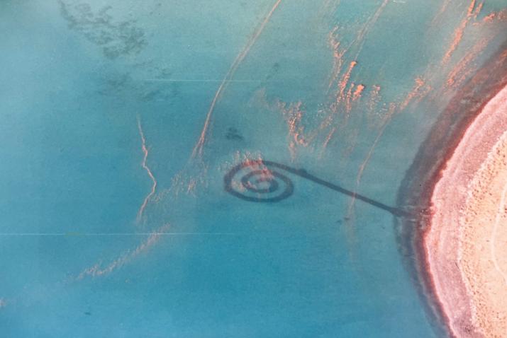
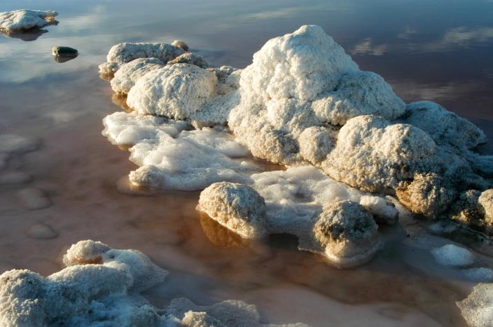
In 1993 Robert Smithson's Spiral Jetty emerged from the Great Salt Lake for the first time in twenty years—bright white, encrusted in salt against the red waters of the Great Salt Lake. Nancy Holt captured this image from a helicopter in 1995.
Dispatch 6
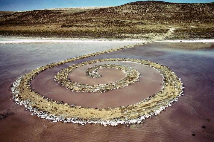
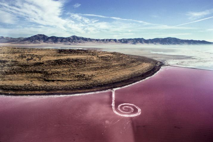
In 2002 Robert Smithson's "Spiral Jetty" emerged once again from the surface of Utah's Great Salt Lake. These images were taken by Matthew Coolidge, founder and director of the Center for Land Use Interpretation.
Dispatch 7
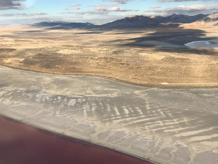
When this image of Robert Smithson's "Spiral Jetty" was taken by Hikmet Loe on December 7, 2016 the level of the Great Salt Lake had fallen to 4,189 feet.
Dispatch 8
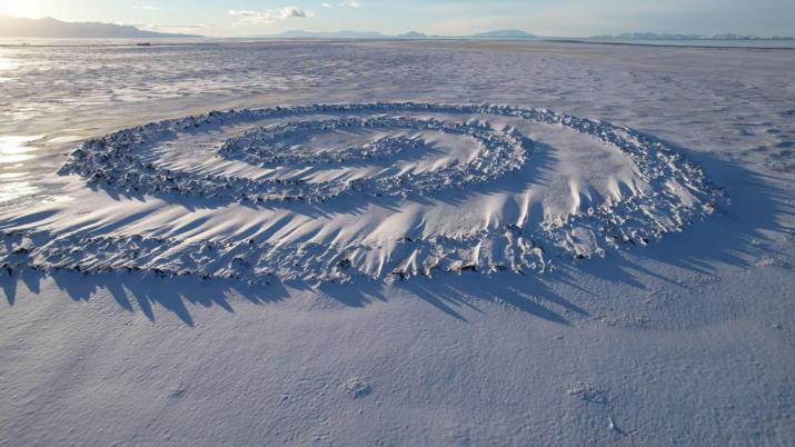
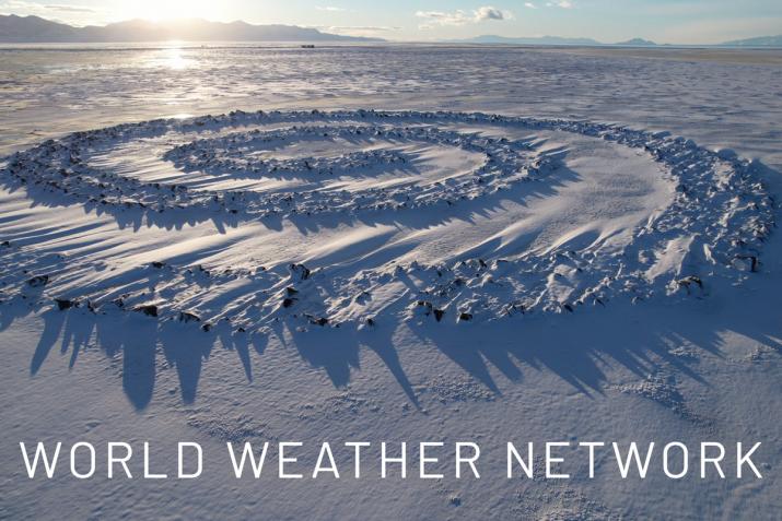
Footage of Spiral Jetty in the snow was taken by Charles Uibel on December 15 2021, when the level of the Great Salt Lake was 4,190 ft—five feet below the lake level during construction of the earthwork in 1970.
Dispatch 9
For our final post in this series we are sharing a dispatch from our Head of Operations & Finance, Brenda Folstad, who traveled to Spiral Jetty in April 2022 to return a stone that was taken from the earthwork. The stone was mailed to the Foundation with the request to return it to Spiral Jetty. Photograph by John J. Wolbers.